|
|
|
|
|
 |
|
| |
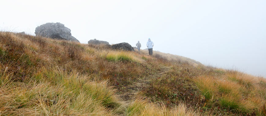
| On a peaceful afternoon at Annapurna
Base Camp (day five of my trek), I chose to hike extra
miles while everybody was at rest. Half of the base camp
compound is a deep glacier ravine, and this ravine is
the path to the peaks of Annapurna I (8091m) and Baraha
Sikhar (Fang, 7647m). I know very well that I will not
have the chance to reach the peaks of these mountains
in my life, but no harm finding out how the trails to
their base camps are like. I requested my guide Rishi
to lead me to the initial route of one of the greatest
expedition - the route to Annapurna I, the 10th highest
mountain in the world. The starting point is some 400
metres away from Annapurna Base Camp, via a dry land of
short grasses and bushes. |
|
|
|
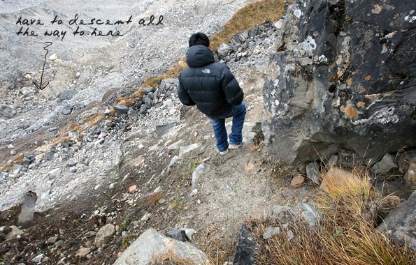 |
| The first trail was already a
test to me - to descend a ridge. The stones, large or
small, were loose and unstable that I slid down several
times and hurt my right ankle. Rishi, as usual, descended
ever steadily without sweat. |
|
|
|
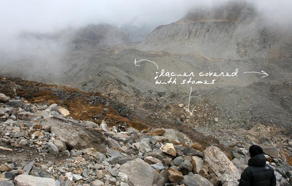 |
| Only half way down the ridge,
staring at the glacier covered with stones below. |
|
|
|
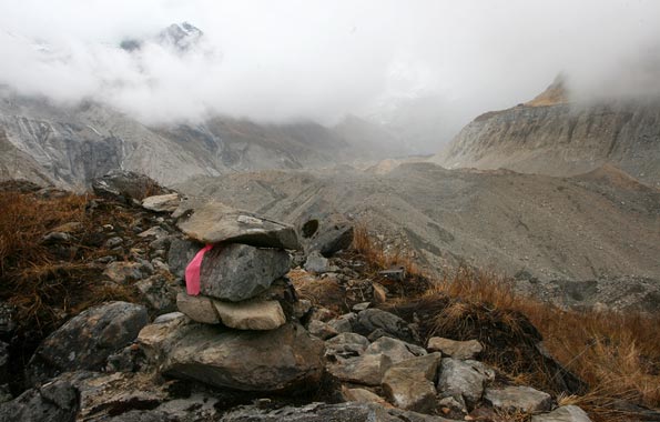 |
| The first sign of the expedition
trail, just in case we lost our direction. |
|
|
|
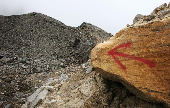 |
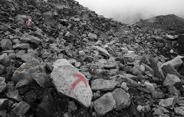
| Down at the bottom now. A huge
arrow painted on a giant rock, how could we miss it! But
Rishi told me that glacier never stay in shape. Glacier
moves, therefore its landscape moves, and the arrow moves
too. Interesting fact huh? |
|
|
|
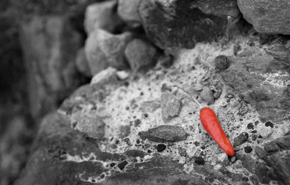 |
| Wow, another expedition sign!
A smart climber could have deliberately left this chili
as a hint of route change. |
|
|
|
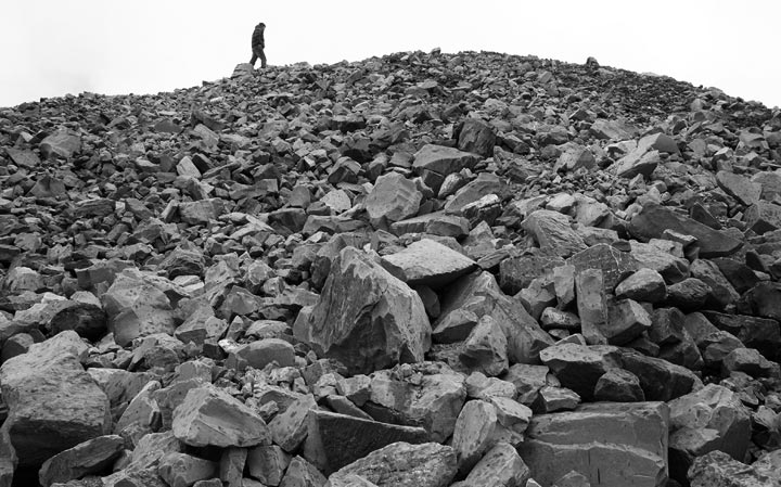 |
| We detoured from the expedition
trail, our main objective was to locate the glacier and
not to climb Annapurna I! Tough climb, especially when
the only things on the grounds are rocks. What's hidden
beneath is a giant glacier river that could collapse any
minute. |
|
|
|
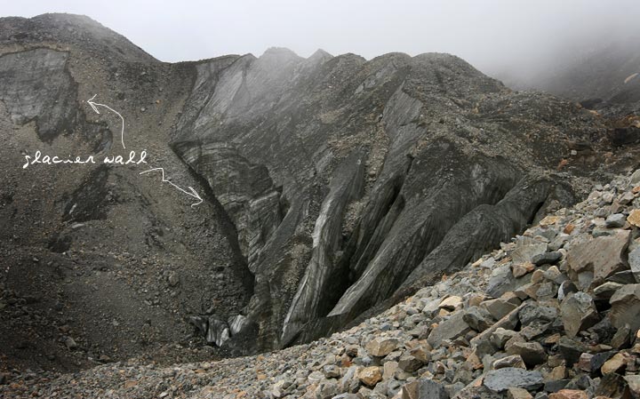 |
| Not long, we sighted an amazing
glacier site. Stones were constantly sliding down from
the glacier wall causing a deafening sound. According
to Rishi, very soon this glacier will collapse and form
a giant lake. It was eerie standing at the ridge looking
down the deep hole at the bottom, no one knows how deep
the glacier is, and I don't want to know! |
|
|
|
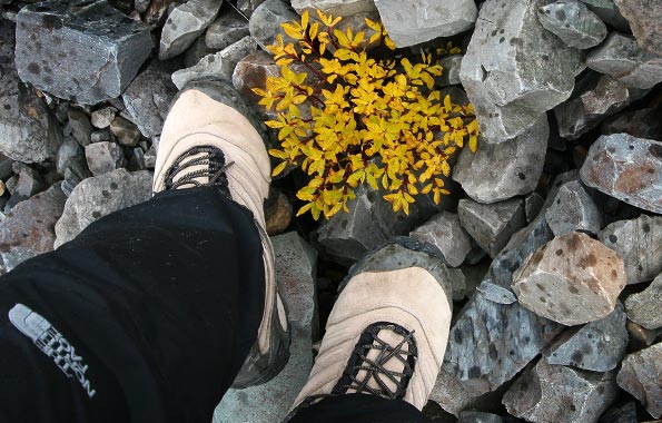 |
| Standing on a glacier covered
with rocks. Flashing my reliable Merrell hiking shoes,
bought in the Philippines! |
|
|
|
 |
| Rishi spotted a gap on the ground,
he claimed it is a potential collapsing line. Without
hesitation, he dug into the gap hoping to find glacier.
Not sure if this was the right thing to do! |
|
|
|
 |
| Enough for the day, it started
to drizzle. On my way back I spotted another sign showing
the way to Fang and Annapurna I. Who knows one day I'll
revisit this place, with the hope of doing something extraordinary
and the dream of reaching the peak of Annapurna I! |
|
|
|
 |
| Looks arid like the Mustang area. |
|
|
|
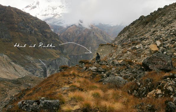 |
| Taking a rest after a long hike.
To be precise, Rishi was actually waiting for me to take
a rest, he needed no rest, being a 'superman' he was. |
|
|
|
 |
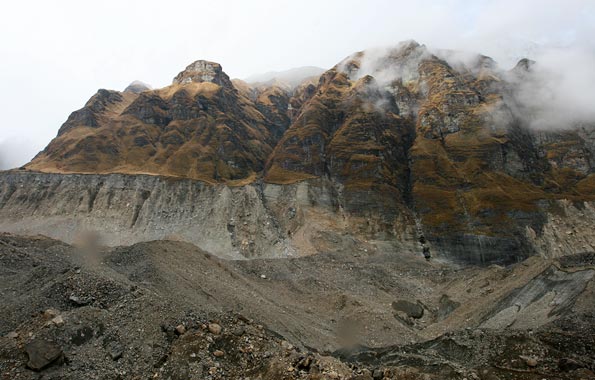
| Annapurna I covered in thick
clouds. |
|
|
|
| |
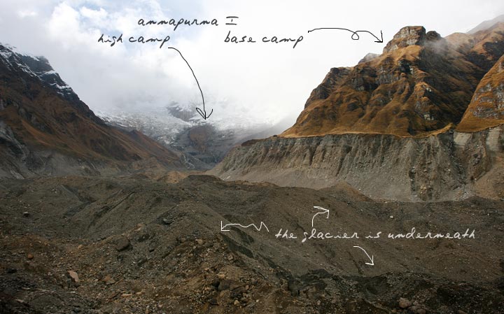
| To give you some perspectives
of the Annapurna I summit expedition trail. One day to
hit the endless glacier route, and hike up the mountain
on the right to the base camp. Another day to reach the
high camp - the first contact point with snow. From there
on, climbers will traverse pass the third camp, fourth
camp and so forth before reaching the peak. It takes between
20 to 40 days depending on individual fitness. I was glad
I had done two percent of the trail. It wasn't the end
yet, I would continue tomorrow! |
|
|
|
|
|
| |