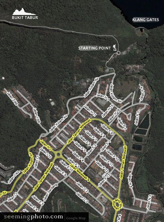
From Middle Ring Road II, turn into Jalan Melawati, and start to look out for the Klang Gates road sign. To reach there you will pass through two roundabouts and end up at Jalan Kolam Air (as shown in the map above. If you end up at a deserted guard house it means that you have taken a wrong turn into Jalan 1/4B). Go straight up until you reach a T junction. Take the left turn into a non-tarmac slip road until you see a big car wheel on your left, painted with the word ‘Welcome’ . Leave your car here, the trailhead is just few steps away from this wheel – same side as the wheel but quite obscure.
We got lost in finding the start of the trailhead and were turning round and round until we finally found the entrance gate not far from the Klang Gates Reservoir, thanks to our GPRS and Google Map. That entrance should be the more difficult East Trailhead, we were inclined to believe. |